
Walker is an Android application for maps while hiking. This is very much a preliminary release, but it does have some unique and noteworthy features.
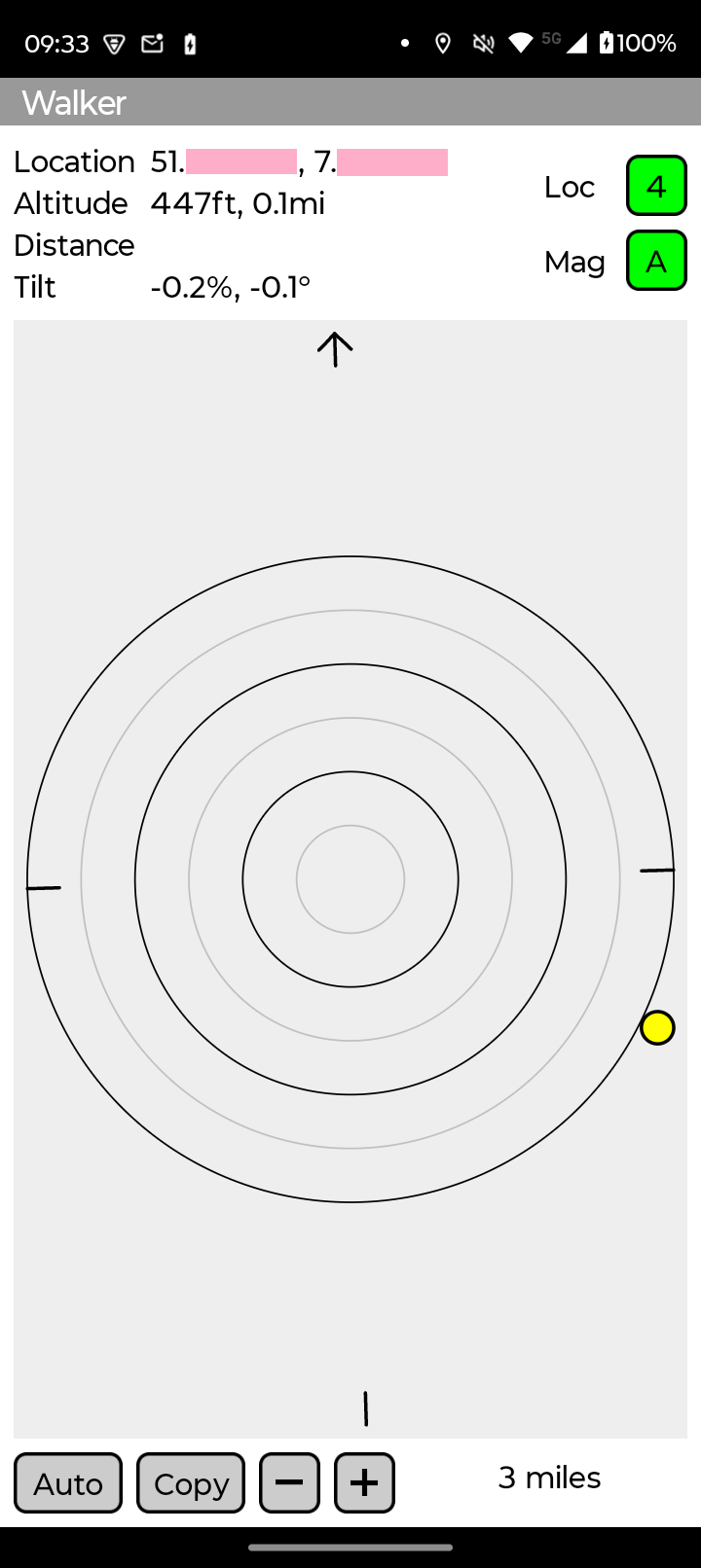
The map always shows the user directly in the center. This allows distance and bearing to a feature to be easily seen. This also allows the sun's position to be correctly indicated relative to the user. This is helpful when magnetometers are often far out of calibration. If you have a home place set in your KML file it will show a vector back home.
Often in mapping applications (including Google Maps) it is not easy to see if the sensors are working correctly. Magnetometers in all phones have significant calibration, thermal and current-induced errors. Recalibration is needed much more often than commonly thought. Android itself is not very good at indicating the necessity of recalibration.
Walker displays location accuracy by the radius in meters of the 68% probability area. This is also accentuated by color codes.
Android supplies low, medium and high as accuracy ratings for the magnetometer. Even a "high" rating is insufficient to guarantee that the device does not need recalibration. Walker tracks the magnetometer and more critically judges if it is accurate. The Android low, medium and high map to "D", "C" and "B". An "A" rating is only given by Walker when the device has proven that it can scan in all directions correctly. If anomalies are later detected the rating will fall back to simply the "B" rating.
When first started Walker will only show "B" for the magnetometer if everything is good so far. You must rotate 360 degrees with the device held mostly horizontal. At that point the rating will switch to "A" if everything is good. If you have doubts later you can try a 360 which might detect and/or automatically recalibrate.
Even if you only use Google Maps, this feature is very handy as the accuracy of the magnetometer applies to all applications.
Walker takes a user-supplied KML file. Use a file manager to select the KML file.
Download Walker-1.0.apk